Multi-rotor UAV

Multi-rotor systems: Mitigate risks and improve inspections

As part of Insitu Pacific’s suite of solutions, we work with you to determine the most efficient and cost-effective method to collect aerial information. Our certified pilots also operate smaller multi-rotor UAVs to address particular inspection and survey needs.

Mining has used multi-rotor drones for many years to conduct fast and accurate inspections of open cast facilities: from volumetric calculations of stock piles, slope stability assessments, pre and post-blast monitoring and inspection, haul route checks, to soil health and tailings monitoring. The applications are endless to ensure that the status of a mine site is visible to all who need the information. Point cloud data, DTMs and DEMs, 3D Modelling and LiDAR mapping can all be integrated into mining operations.

In addition, with modern payload capabilities such as the Riegl Vux LiDAR, high accuracy photogrammetry, FLIR or EO/IR technologies on board, the information available to teams on the ground is further enhanced. 

Improve safety and reduce environmental impact

Keeping people safe is fundamental to any operation. Looking after the environment and ensuring minimal impact in everything we do is paramount. Multi-rotors can effectively capture spatial data where conventional manned aircraft and BVLOS Fixed wing UAVs cannot operate, such as highly mountainous and vegetated terrain.

Industries that require visual inspection of assets can benefit from implementing multi-rotor UAV inspections to collect close visual data on the condition of an asset as part of regular maintenance procedures without putting inspectors at risk in potentially dangerous situations, such as high towers, powerlines or underground mines.

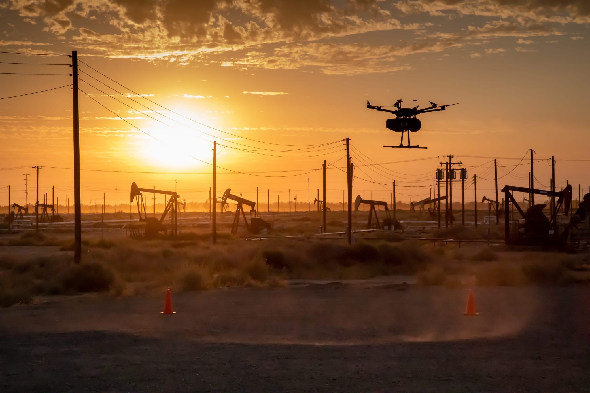
Oil and Gas multirotor UAV inspection
 Insitu Pacific - Multi-rotor UAV

Reduce downtime and improve efficiency

We collaborate with our customers to perform rigorous inspections to collect aerial imagery to identify problems or maintenance issues that can cause inefficiencies or downtime, and deliver quality data products that are integrated into your systems to extract valuable insights.

By having powerful sensors covering an entire asset in less time than traditional methods, inspectors can cover more assets in less time. Asset inspection using multi-rotor systems has many monitoring applications that can be applied. For example, fugitive emission sensors accurately pick up the smallest volumes of emissions from various assets. Leak detections of the smallest nature can pin-point a significant preventative maintenance issue, ultimately ensuring cost efficiency with maximised safety.

Innovative use cases

Mining digitisation for blast monitoring

In partnership with Blast Movement Technologies, Insitu Pacific has developed software as part of a unique airborne method to locate and map blast detectors using the Flight Enabled Detector (FED).

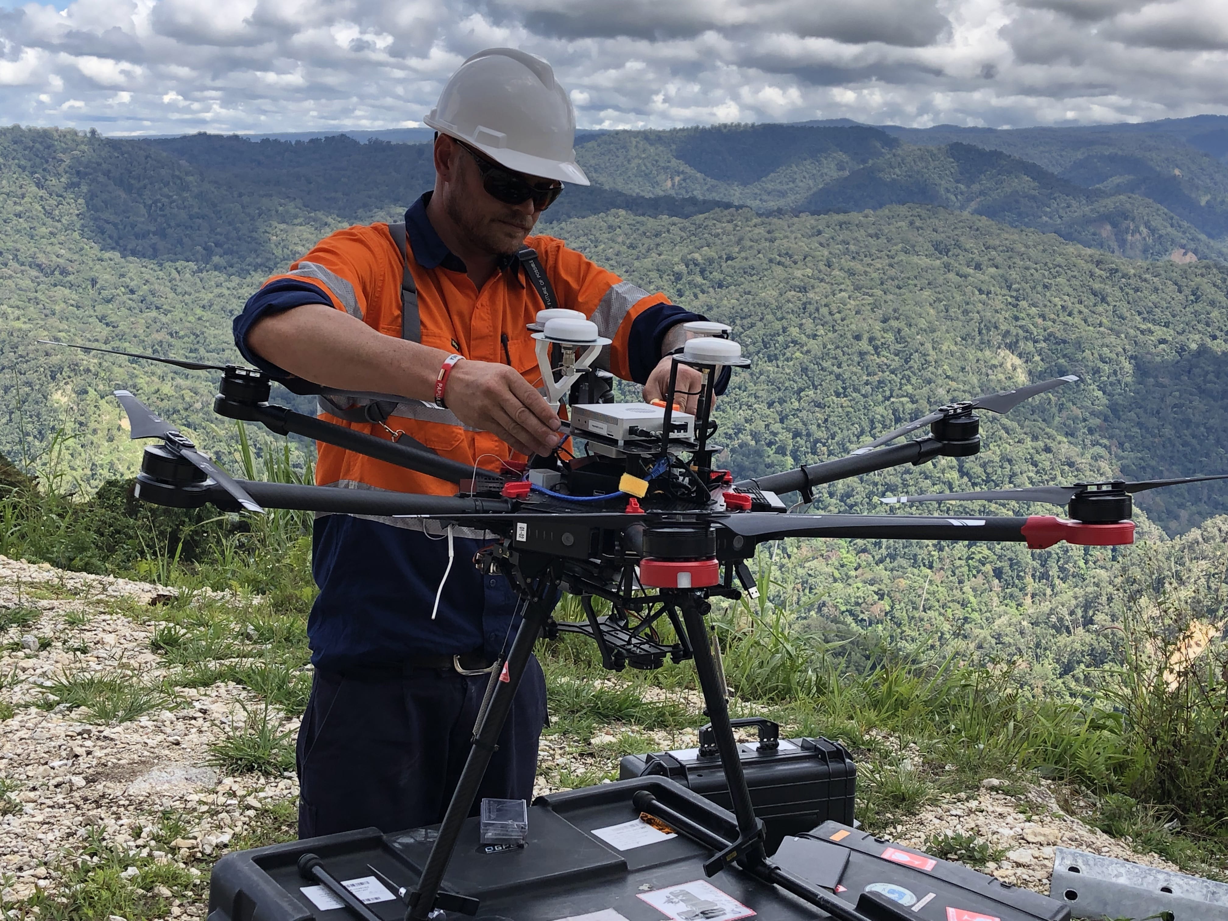
A built-in GNSS sensor aboard a DJI M600 Pro Airframe records the Blast Movement Monitor’s depth over blast piles and safely and efficiently retrieves in-depth data post blast. As safety in mining is ever more important, the need to keep miners away from potential hazards is a critical component to any mine. Any unevenness in the terrain after blasting is easily overcome with an airborne solution and time to survey a site is greatly reduced. 

Insitu Pacific now uses its AS9100D certified production system to manufacture and support FEDs on behalf of BMT for their global mining customers. In addition to providing repairs and servicing units as required, we also deliver onsite training on FED operations in compliance with local regulatory requirements as a sub element of BMTs complete training package for their systems

 Insitu Pacific - Multi-rotor UAV

Connect with us on +61 7 3182 4000 or send us an email

Tethering capability for emergent issues

Gain greater situational awareness with Insitu Pacific’s multirotor tethering capability – a rapid response tool to support site incident management, emergency and disaster management, and operational planning.

Quick to deploy and compact, tethered solutions are usable anytime, anywhere. With the potential to be applied to multiple airframes, an RPAS tethering capability delivers a persistent broad area view, which can be used to: support emergency management; improve communications across large sites; monitor blast operations; monitor fume and air quality; monitor fugitive emissions; and monitor security of critical infrastructure.

Information can be live-streamed to field managers and to smart devices at headquarters. You can put safety first and have real-time, critical information delivered on onsite so your experts can make the right decision in hazardous conditions, and avoid placing people in harm’s way.

 Insitu Pacific - Multi-rotor UAV

Insitu Pacific

 Insitu Pacific - [Page Template] - Footer