 https://insitupacific.com.au/wp-content/uploads/DAA_IPL-LinkedIn-scaled.jpg
804
1600
Rebecca Kind
https://insitupacific.com.au/wp-content/uploads/insitu-pacific-logo-1500x630.png
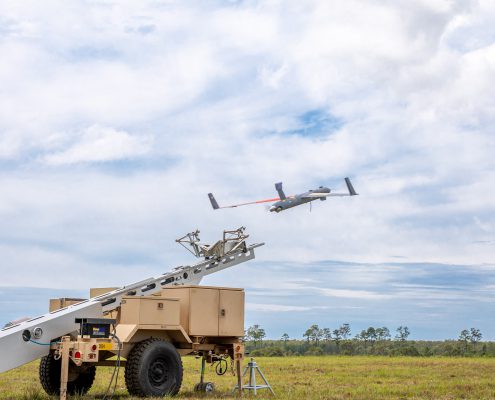
Rebecca Kind2022-08-25 15:54:422022-08-25 15:54:45BVLOS RPAS Littoral Mapping
https://insitupacific.com.au/wp-content/uploads/DAA_IPL-LinkedIn-scaled.jpg
804
1600
Rebecca Kind
https://insitupacific.com.au/wp-content/uploads/insitu-pacific-logo-1500x630.png
Rebecca Kind2022-08-25 15:54:422022-08-25 15:54:45BVLOS RPAS Littoral MappingCase Studies
https://insitupacific.com.au/wp-content/uploads/DAA_IPL-LinkedIn-scaled.jpg
804
1600
Rebecca Kind
https://insitupacific.com.au/wp-content/uploads/insitu-pacific-logo-1500x630.png
Rebecca Kind2022-08-25 15:54:422022-08-25 15:54:45BVLOS RPAS Littoral Mapping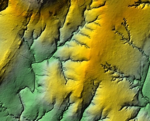 https://insitupacific.com.au/wp-content/uploads/Lidar-feature-image.jpg
1394
2000
Rebecca Kind
https://insitupacific.com.au/wp-content/uploads/insitu-pacific-logo-1500x630.png
Rebecca Kind2021-02-01 16:49:002021-02-22 21:53:45Discovering true value in data – an exploration breakthrough
https://insitupacific.com.au/wp-content/uploads/Lidar-feature-image.jpg
1394
2000
Rebecca Kind
https://insitupacific.com.au/wp-content/uploads/insitu-pacific-logo-1500x630.png
Rebecca Kind2021-02-01 16:49:002021-02-22 21:53:45Discovering true value in data – an exploration breakthrough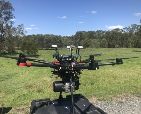 https://insitupacific.com.au/wp-content/uploads/IMG_2032.jpg
1200
1600
Rebecca Kind
https://insitupacific.com.au/wp-content/uploads/insitu-pacific-logo-1500x630.png
Rebecca Kind2020-11-01 16:48:002021-02-17 07:23:48Environmental Survey
https://insitupacific.com.au/wp-content/uploads/IMG_2032.jpg
1200
1600
Rebecca Kind
https://insitupacific.com.au/wp-content/uploads/insitu-pacific-logo-1500x630.png
Rebecca Kind2020-11-01 16:48:002021-02-17 07:23:48Environmental Survey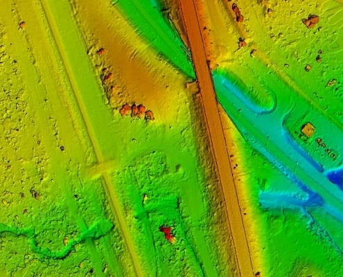 https://insitupacific.com.au/wp-content/uploads/Road-and-Rail-DSM-Road-MiD-Zoom-Low-Res.jpg
752
1015
Rebecca Kind
https://insitupacific.com.au/wp-content/uploads/insitu-pacific-logo-1500x630.png
Rebecca Kind2020-11-01 16:47:002021-02-17 07:24:46Asset Inspection Road and Rail Corridor
https://insitupacific.com.au/wp-content/uploads/Road-and-Rail-DSM-Road-MiD-Zoom-Low-Res.jpg
752
1015
Rebecca Kind
https://insitupacific.com.au/wp-content/uploads/insitu-pacific-logo-1500x630.png
Rebecca Kind2020-11-01 16:47:002021-02-17 07:24:46Asset Inspection Road and Rail Corridor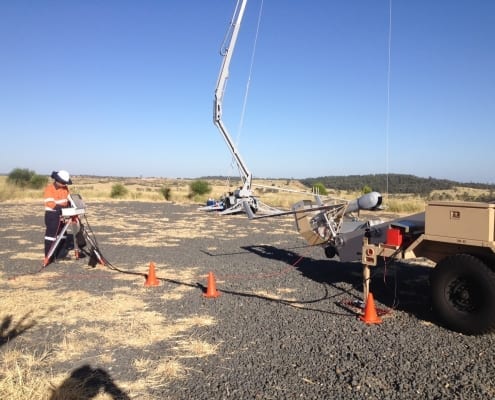 https://insitupacific.com.au/wp-content/uploads/JD-Pre-Launch.jpg
1224
1632
Rebecca Kind
https://insitupacific.com.au/wp-content/uploads/insitu-pacific-logo-1500x630.png
Rebecca Kind2020-10-01 16:46:002021-02-17 07:26:44Oil and Gas Operations
https://insitupacific.com.au/wp-content/uploads/JD-Pre-Launch.jpg
1224
1632
Rebecca Kind
https://insitupacific.com.au/wp-content/uploads/insitu-pacific-logo-1500x630.png
Rebecca Kind2020-10-01 16:46:002021-02-17 07:26:44Oil and Gas Operations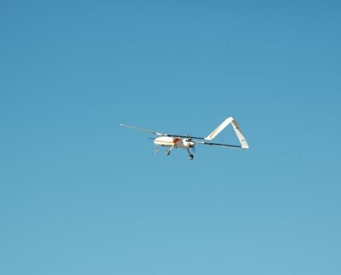 https://insitupacific.com.au/wp-content/uploads/PLACEHOLDER-FOR-INEXA-VIDEO.jpg
2000
3008
Rebecca Kind
https://insitupacific.com.au/wp-content/uploads/insitu-pacific-logo-1500x630.png
Rebecca Kind2020-10-01 16:43:002021-02-17 07:25:44Mining Exploration
https://insitupacific.com.au/wp-content/uploads/PLACEHOLDER-FOR-INEXA-VIDEO.jpg
2000
3008
Rebecca Kind
https://insitupacific.com.au/wp-content/uploads/insitu-pacific-logo-1500x630.png
Rebecca Kind2020-10-01 16:43:002021-02-17 07:25:44Mining Exploration